Showing posts with label May. Show all posts
Showing posts with label May. Show all posts
Sunday, December 18, 2016
Chain of Lakes May 2
Two days of wind and rain followed by a day of wind and rain and how has brought the river levels up several feet. The Quinnipiac and the Farmington are well out of their banks and into the trees and it can be assumed that all the others have followed suit. Exploring the bottom of the Scantic is put off.
So, I head to a small chain of three lakes, each separated by a short portage, which only serves to make the trip more worthwhile...the act of lifting and carrying the boat from one body of water to the next being what canoes were made for.
The first lake is housed, an older development plan that let people build all too close to the water... but even that seems to have purpose in the journey. I paddle away from town across and up the egg shaped lake to the far end and towards something farther away.
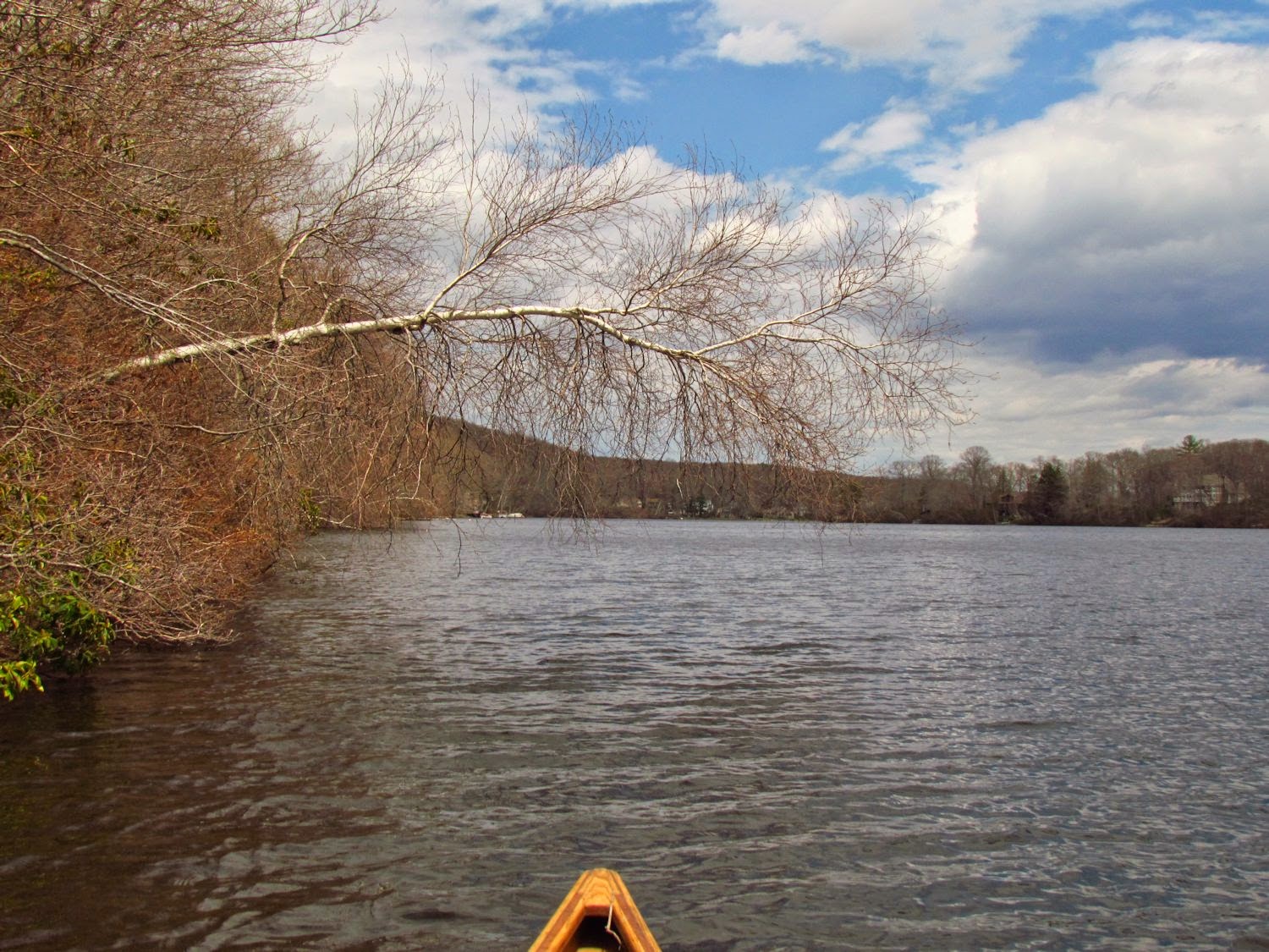
Just as I reach the top of the lake, a mature bald eagle drops down off the forested hillside and sweeps off leading the way. I grunt the portage...so short that except for my pack and one paddle, I leave my other gear in the canoe and forgo throwing it up on my shoulders, just manhandling it into the second lake, where I slip off the bank and perform the wetting of the feet ceremony. This second lake has houses also, but they are back farther from the shore, which is only half developed, and the lake has a dogleg in it with a rather fine stone gazebo at the point, which would bother me if it wasn't such a fine classic design.
The second portage is easier, being just as long, or short as the case may be, but without a hump to carry over. I guy is fishing there on his lunch break. We have a short chat before he figures out that I'm not fishing. Usually, if fishermen figure out that I am canoeing without fishing before talking with me, they treat me as if I was deranged. If we do it the other way around, I end up being one of the guys. I do like to pick their brains and get their observations since they have a different focus on it all. He did not see the bald eagle, if it came this way.

It is this third lake that is the pearl of the trip. It is S-shaped and has just two or three houses that can be seen from the water. The first is at the portage and the others are high and away from the lake...and they can and should be ignored. The lake is shallow enough that I bet one could wade across it most anyplace. It is also exactly the right depth to grow lily pads, and by June it will be blanketed in them and nearly uncanoeable. A rocky forested ridge forms much of the east shore while the rest of the boundary is low wetland or swamp. An osprey perches in a tree on the east shore until I come too close, whereupon it gets up and moves to a tree on the west shore (later, it will reverse the process). I flush a great blue heron, which moves off no farther than it feels necessary so that it continue hunting without having to watch me.

Canada geese and I spot two nests on isolated hummocks that are well out in the lake. The closest one has eggs but the female has left the nest. I'm not to blame as she was gone well before I got near...I spotted her head low swimming next to her mate. I've observed geese before, I've never seen them leave a nest like that unless it has been raided. I move past as quickly as I can.
I spend less time in the swamp than I planned keeping in mind the stiff grind that the return trip could become. The high water makes it a good day to explore the narrow channels that lead into the low cedar tree swamp, but the wind...


And then I work my way back to town.

Wednesday, September 21, 2016
Exhibitions in May
I'm a bit under the weather with the chest cold stuff that's going around here.
However, I have artwork from the View from the Canoe Project up in two Seattle galleries during May.

a group exhibition at West Seattle's ArtsWest gallery.
Zanetka Gawronski, Rebecca Deren and Emily Cooper with my work in the alternative media platform (AMP). I'll be showing a 9 minute video loop and fourteen hand-carved functional art canoe paddles from my View from the Canoe Project.
April 26 - May 21 with a reception on May 12 from 6 to 7:30pm.
artswest.org for more information

E4C Gallery -
And, a custom four screen piece based on my video, 'The Drydocks', begins showing at the E4C gallery at the King County 4Culture space in Pioneer Square in Seattle. The E4C features the work of several artists, rotating all day long. The gallery turns on at 7am and runs until 10pm. The screens face the street and are viewed from the sidewalk.

There are also 4 View from the Canoe photographs on James St. between 3rd and 4th avenues. There up for a few more months and since they are 4 x 5 feet, or so, you can't miss them.
Wednesday, September 14, 2016
Yakima River Day 1 May 24 2010
The Yakima River runs east about 180 miles from the Cascade Range of Washington State to the Columbia River at the city of Richland. Parts of the upper 50 miles are frequently used by rafters, fisherman and floaters, but we found almost no information on major portions of the lower river nor did there seem to be any written record of anyone canoeing the full length, although, someone must have done this before - it's too obvious of a route. Today's photos by Mike Plahuta
Mike and I set out just before noon at Ringer Road near Ellensburg, 148 miles from the Columbia River. We know what is ahead for the next 20 miles. From here, we paddle through the last of the Ellensburg range country, the river banks lined with trees with open land beyond. Soon, we enter the Yakima Canyon with its 1000 foot high hillsides, a combination of rocky land with the barest of vegetation, basalt outcrops, castles and cliffs, and river banks with straggly trees if any, but with beautiful patches of tule reeds.  The current is moderate and the bends in the river broad so that we can see well ahead of us. Occasionally, we pass through some standing waves that are just large enough to splash a little water into the canoe. We see eagles and magpies, a few kingfishers, many red wing blackbirds, some yellow song birds (warblers or goldfinches?), some mule deer and Mike spots a handsome western tanager with its yellow body and red head. Our first portage comes at the Roza Diversion Dam. It is a low, but dangerous overflow dam that diverts water to an irrigation canal. The portage is safe and easy on the river-right bank just upstream of the dams warning sign. It is an easy 250 yard carry back to the river below the dam.
  We have no information on this next section of river so we move ahead alert and with caution. It is quite beautiful with basalt cliffs running directly down to the water. The river alternates between flat slow sections that are a few feet deep and steeper fast stretches with only six inches in water where we frequently feel the cobbles bump the bottom of the canoe. The bottom is paved with basalt rocks and unlike many rivers, it is uniform in depth from side to side. Soon, the canyon opens up into a more arid eastern Washington and the cliffs are replaced with outcrops and brushy riverbanks. Here, the water becomes more challenging. The rapids are minimal, but some of the bends are quite sharp and quick and accurate maneuvering is required to keep from piling into the cut banks, banks that would make it difficult to exit the river in the event of a spill. We hit some larger standing waves that splash small amounts of water into the canoe.
The current is moderate and the bends in the river broad so that we can see well ahead of us. Occasionally, we pass through some standing waves that are just large enough to splash a little water into the canoe. We see eagles and magpies, a few kingfishers, many red wing blackbirds, some yellow song birds (warblers or goldfinches?), some mule deer and Mike spots a handsome western tanager with its yellow body and red head. Our first portage comes at the Roza Diversion Dam. It is a low, but dangerous overflow dam that diverts water to an irrigation canal. The portage is safe and easy on the river-right bank just upstream of the dams warning sign. It is an easy 250 yard carry back to the river below the dam. We have no information on this next section of river so we move ahead alert and with caution. It is quite beautiful with basalt cliffs running directly down to the water. The river alternates between flat slow sections that are a few feet deep and steeper fast stretches with only six inches in water where we frequently feel the cobbles bump the bottom of the canoe. The bottom is paved with basalt rocks and unlike many rivers, it is uniform in depth from side to side. Soon, the canyon opens up into a more arid eastern Washington and the cliffs are replaced with outcrops and brushy riverbanks. Here, the water becomes more challenging. The rapids are minimal, but some of the bends are quite sharp and quick and accurate maneuvering is required to keep from piling into the cut banks, banks that would make it difficult to exit the river in the event of a spill. We hit some larger standing waves that splash small amounts of water into the canoe. As we near the city of Yakima, the current picks up speed and when the Naches River enters, the volume of water really increases while the water temperature drops 10 degrees or more due to the snowmelt water. We pass an eagle nest, we see ospreys, herons and the first white pelicans. We have permission to camp in the rough at a state park along the river, but cannot figure out where it is. Around 8pm, we know we have missed it by a mile and pull the canoe into a small channel on river-left where we find a nice spot to camp.
 While we can hear I-82, it would be miles of walking and wading for anyone to reach us. It is a good spot. Pelicans fly past often and a hawk calls repeatedly from a nest just upstream of us. There are also many common mergansers around, with their newly hatched ducklings.
 We are somewhere near mile 111 - distance for the day, about 37 miles The Ellensburg-Roza Dam section is beginner-intermediate water at this water level - Umtaneum gauge 2400 cfs. The Roza-Yakima section is intermediate paddling - Below Roza guage 1300 cfs
Subscribe to:
Posts (Atom)


